
- Home
- Entire Malaysia
- Selangor▼
- Professional/Business Equipment
- Alpha 4i RTK GNSS Receiver Base & Rover GPS Survey
Alpha 4i RTK GNSS Receiver Base & Rover GPS Survey
List-ID: 11057126209 Sep 19:50
Description
Specification
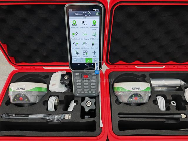
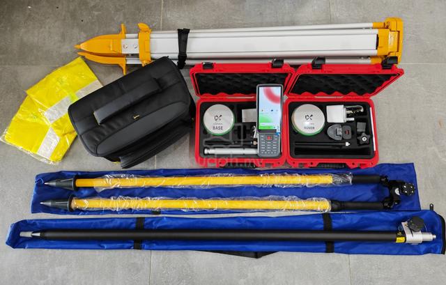
- Alpha 4i Ultra RTK GPS Surveying Instruments
Smaller GNSS BASE & ROVER with IMU Tilt Function Receiver Fullset
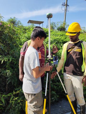
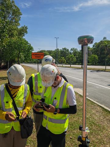
Application: GPS Control, Topo Survey, As-Built, Stake-out, Jungle Survey, Site Calibration, Engineering Survey, Marine Survey, Land survey
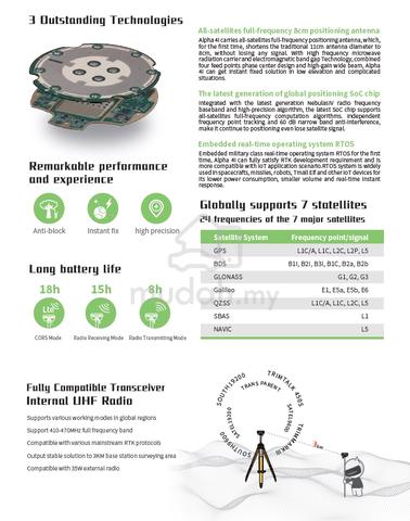
SATELITES SIGNAL TRACKING: GPS, GLONASS, BeiDou, Galileo, QZSS, SBAS & Navic
GPS: L1C/A, L1C, L2C, L2P, L5
GLONASS: G1, G2, G3
BEIDOU: B1I, B2I, B3I, B1C, B2a, B2b, ACEBOC
GALILEO: E1,E5a, E5b, ALTBOC, E6
QZSS: L1C/A, L1C, L2C, L5
SBAS: L1, L5
NAVIC: L5
RTK accuracy: Horizontal: ± 8mm + 1ppm, Vertical: ± 15mm + 1ppm
Static accuracy: Horizontal: ± 2.5mm + 1ppm, Vertical: ± 5mm + 1ppm
Channel: 1408 Channels
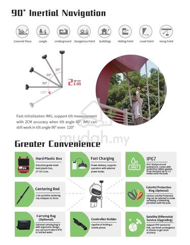
IMU Tilt: 90 Degree
Function Features:
Intelligent double electric, Handheld universal
The host comes standard with two large-capacity smart lithium batteries, and is common with the handheld battery, comes with a power detection chip, a key that knows the remaining power, dual batteries, hot switching, bring you never-ending measurement experience.
Solid as gold soup, solid as a rock
The body of Alpha 4i main machine body is made of pure magnesium alloy material, which has more excellent electromagnetic shielding performance and more lightweight solid body, which ensures the stable and reliable operation of equipment.
Combined antenna, complete machine optimization
Using a new combination of antennas, GNSS, WIFI, Bluetooth, 4G set as a whole, the new design (more concise) of the internal structure, the whole system-level optimization, brings a more pure internal electromagnetic environment and better signal performance.
Multiple communication connections
WiFi, Bluetooth, RTK host network connection, support IGRS pairing, users can choose the connection method according to the specific job, flexible and efficient.
Site elevation
Various elevation model files, such as triangular nets, are self-built and imported for site elevation staking to facilitate site elevation control.
Background map
Support SHP, DXF and other user data to add, support offline and online Baidu map display, there are maps and the truth.
** Our workshop located at Malaysia and available spare parts for repairing and maintenance in future.
** We have 25 years experienced engineer to repair and calibrate all type of survey instruments.
~~ Please feel free to contact us if you require further information/clarification on the product. ~~
#alpha #g-tech #4i #imu #chc #tiltsurvey #4irtk #surpad #xpad #map #dimap #fixed #imu #g970ii #gps #rtk #gnss #unistrong #survey #receiver #totalstation #xpad #landsurvey #civil #beidou #south #southgnss #southgps #dimappro

Mudah Safety Tip
Reminder! Our staff will NEVER reach out to you through other platforms or channels outside of Mudah.my. Find out more safety tips in MudahSafety!
Do you find this ad suspicious or inappropriate?
Report this ad (List-ID: 110571262)Is this your ad? Manage it using these links.
You May Also Like

Price
10%RM 18,800
RM 16,800
Location
Selangor - Bandar Kinrara
Condition
New
Shortlist, compare, decide — faster on the app.
Scan QR to Download App


4.7
200K+ reviews
Company
Joined since: Sep 2013
Share this ad