- Home
- Entire Malaysia
- Melaka▼
- Sports & Outdoors
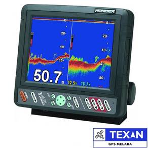
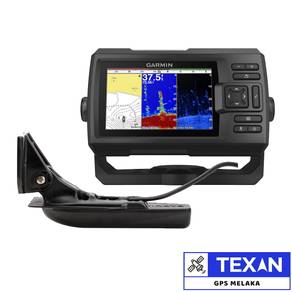
- JMC V-6810P Marine GPS Track Plotter & Sonar Fish
JMC V-6810P Marine GPS Track Plotter & Sonar Fish
List-ID: 8663103128 May 13:39
Description
Specification
- Feature
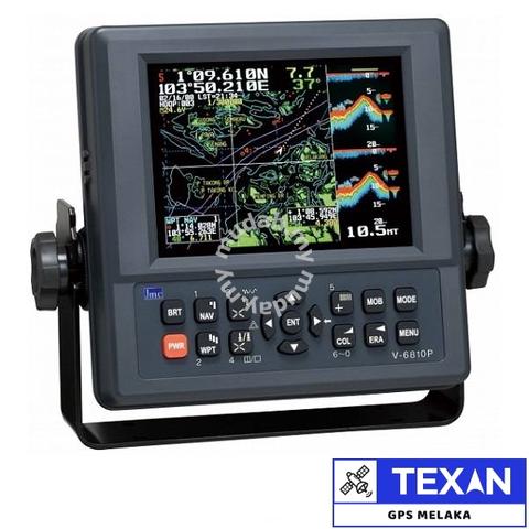
Combined GPS track plotter and dual-frequency commercial fish finder housed in electrostatically shielded compact, sturdy ABS cabinet for long-term reliable operation in severe marine environment.
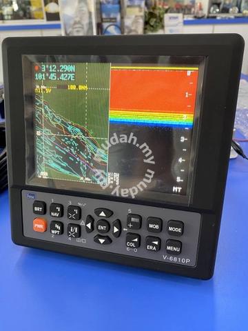
Display modes include dual simultaneous display across 6.4-inch VGA LCD of track plotting screen and fish finding imagery, full screen display of either high or low frequency echogram and dual split screen display of high and low frequency echograms.
Screen backlit with white LEDs for long service life with 10 selectable brightness levels to suit the varying ambient lighting condition.
The fish finder is equipped with all functions needed for professional fishing, including automatic selection of optimum transmit pulse width depending on range in use, TVG, automatic bottom tracking, bottom-locked or pelagic expansion, Whiteline, echo threshold, echo dynamic range setting, adjustable velocity standard and A-scope.
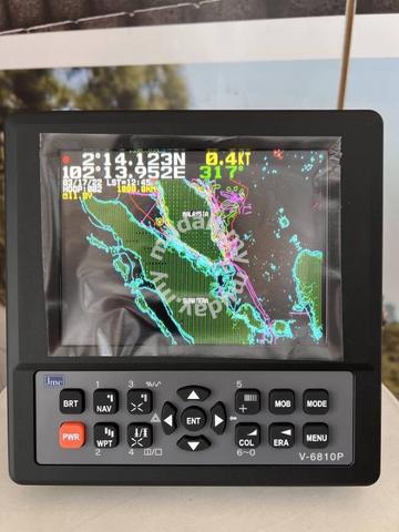
Supplied with built-in precision map usually tailor-made by your dealer for your favorite area of operation, requiring no external chart cartridges.
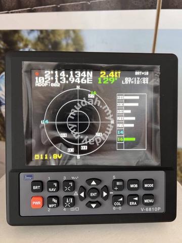
Permanent storage of waypoints, boundaries, routes, and track points in internal non-volatile memory.
Audible and visual alarms include anchor watch, arrival, boundary, cross-track error, depth, fish, GPS fix and power failure.
Devoted MOB key for instant storage of, and quick, Straightline returning to, emergency position; protected against unintended erasure or overwriting.
Equipped with industry standard NMEA-0183 interface for data transfer to/from peripheral devices.
12V regulated DC output is available for powering a light-duty peripheral device.
Multi language menu including major Asian languages (e.g., Chinese, Gujarati, Korean and Thai)
A water temperature sensor is optionally available.
Specification
Screen: 6.4" TFT-LCD, VGA (680 x 480 pixels)
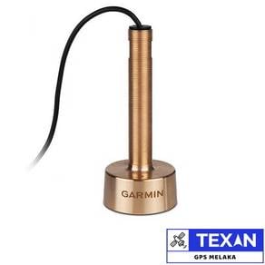
GPS Receiver: 18-channel parallel, 1575.42 MHz C/A code, WAAS/DGPS-ready
Map: User-specified between 85 degrees. n/s
Map Scale: 1/2,000-1/25,000,000 or 0.1-1,599 n.m. in 30 steps
Discrete Waypoints: 4000/8000 with/without name tags + 1 MOB point
Route Waypoints: 100, reversible
Boundary Points: 2800 (7 colors x 400 pt. each)
Track line Storage: 8000 (time/distance)
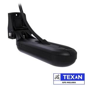
Transducer: 50-200 kHz dual frequency
Transmit Power: Approx. 400W RMS (3.2 kW p/p)
Depth Ranges: 15 ranges, 2.5-1000 m/fth/br, 5-3000 ft
Audible & Visual Alarms: Anchor Watch, Arrival, Boundary, Cross-Track Error, Depth, Fish, Low Voltage, GPS Satellite Unlock
Interface: NMEA-0183
Cabinet Weight: approx. 2.01 kg with bracket
Power Requirements: 11 to 40 VDC, approx. 15W
Environment: IEC 60945-2002 (cabinet/protected category, GPS antenna/exposed category)
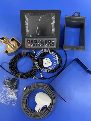
What is in the box:
V-6810P Track Plotter/Fish Finder
Dual Frequency 50/200kHz Bronze Thru Hull Transducer with 10m Cable
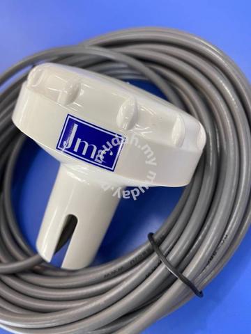
GPS Antenna with 10m Cable fitted with 1 COAX Plug
Mounting Bracket
Display Cabinet Clamping Knobs x 2
Viewing Hood
Power Supply Cable with Fuses x 2
User Manual
One Year Warranty
🏢Texan Telecommunications
📬G1, Block Mawar 1, Jalan Murni 2, Taman Malim Jaya, 75250, Melaka, Malaysia.
☎️Tel:
📱H/P: (WhatsApp)
📧Email:
🖥Website: www.texantel.com.my
📍GPS Coordinate: N2° 14.139 E102° 13.944
Mudah Safety Tip
If it is a meet-up/COD, always inspect item condition on site before paying. Find out more safety tips in MudahSafety!
Do you find this ad suspicious or inappropriate?
Report this ad (List-ID: 86631031)Is this your ad? Manage it using these links.
You May Also Like


Price
RM 6,800
Location
Melaka - Melaka Tengah
Condition
New
Shortlist, compare, decide — faster on the app.
Scan QR to Download App


4.7
200K+ reviews
Company
Joined since: Sep 2009
Share this ad